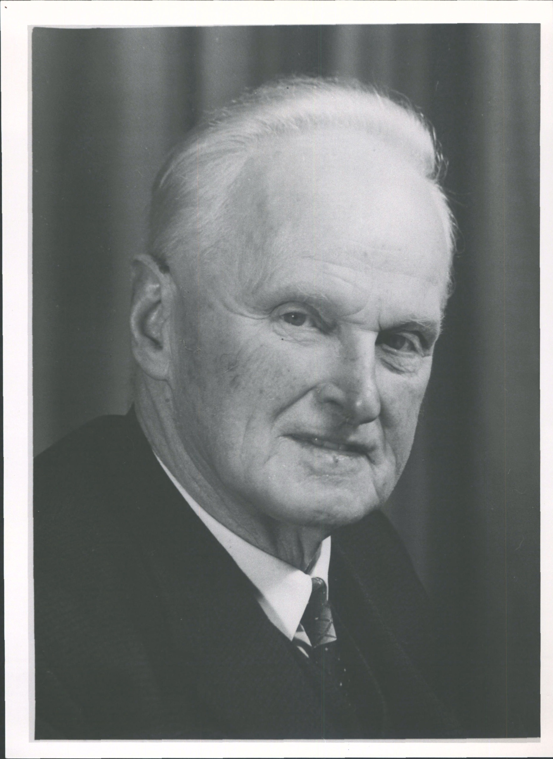
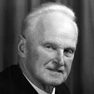
James Herries Beattie
James Herries Beattie (1881 - 1972) was the most prolific collector of Ngāi Tahu histories, place names and traditions. Beattie developed a wide-ranging and lasting interest in the traditional lifestyle and history of Ngāi Tahu in southern New Zealand, and would often travel by train and bicycle to isolated Ngāi Tahu communities interviewing Ngāi Tahu kaumātua.
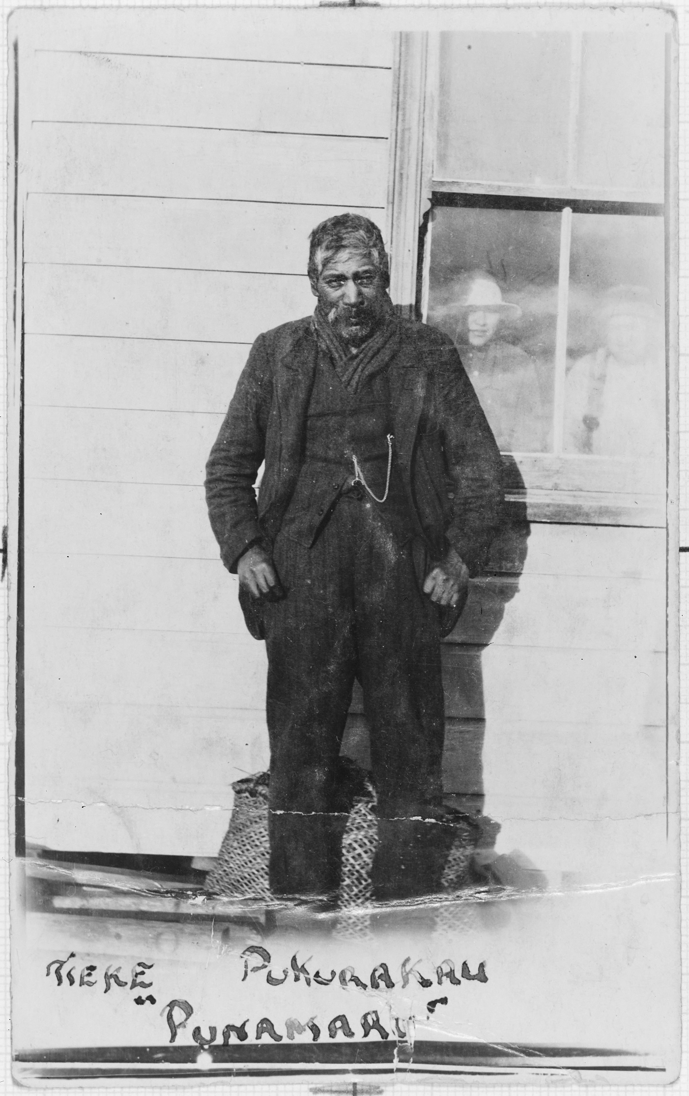
In December 1915 Beattie travelled to Glenavy to interview Taare Te Maiharoa. While Beattie was waiting to interview Taare he met Tieke for the first time. Years later Beattie reflected on this initial encounter:
We drifted into conversation when he mentioned three Maori place-names he said that some of the fishing camp Pakehas wanted him to give the Maori names of islands in river near Waitaki mouth and he refused unless they gave him 2/- each and as they loved their silver better than their information nothing eventuated. I said ‘I hope you don’t expect I am going to pay you for what you are telling me?’
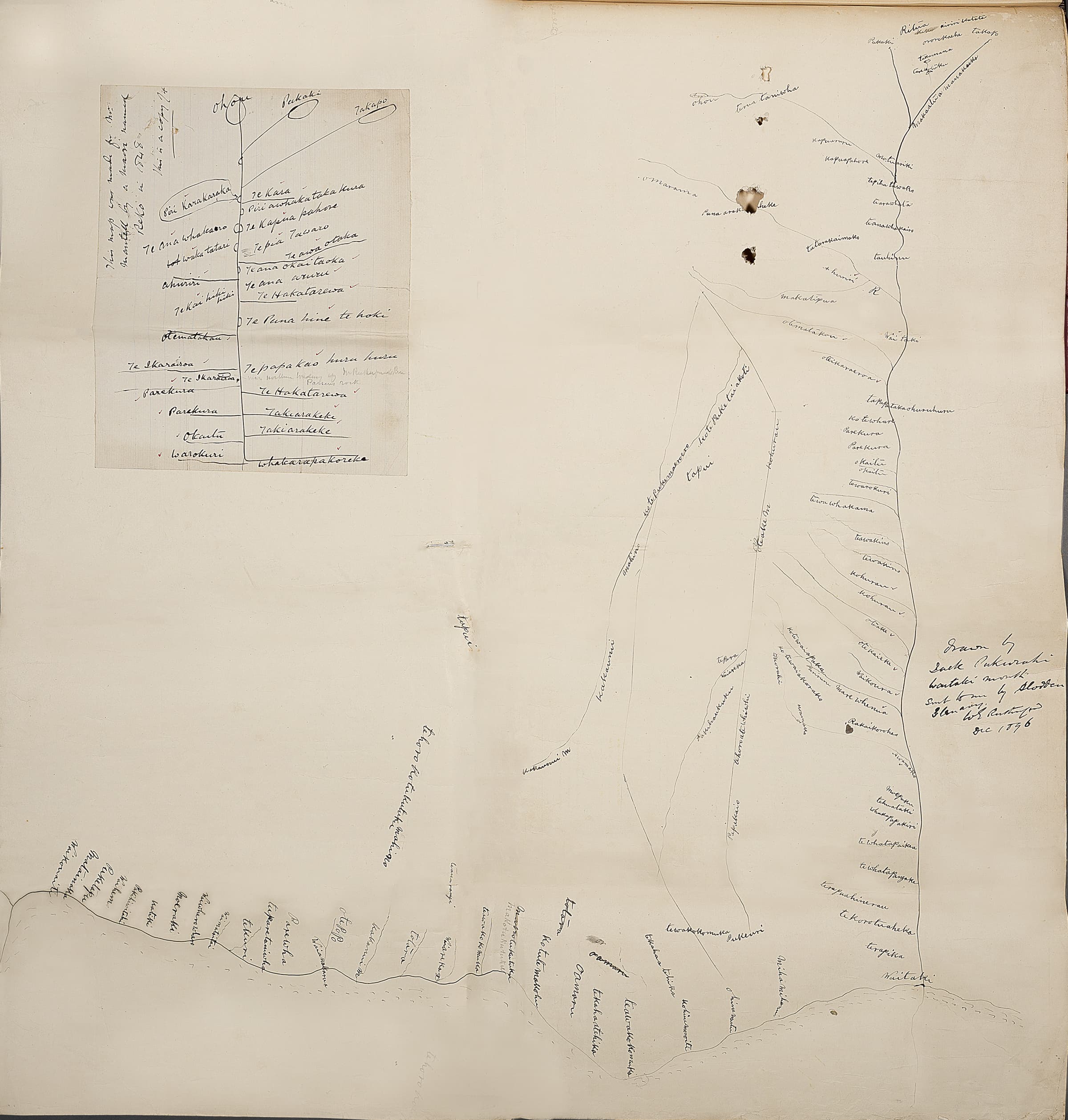
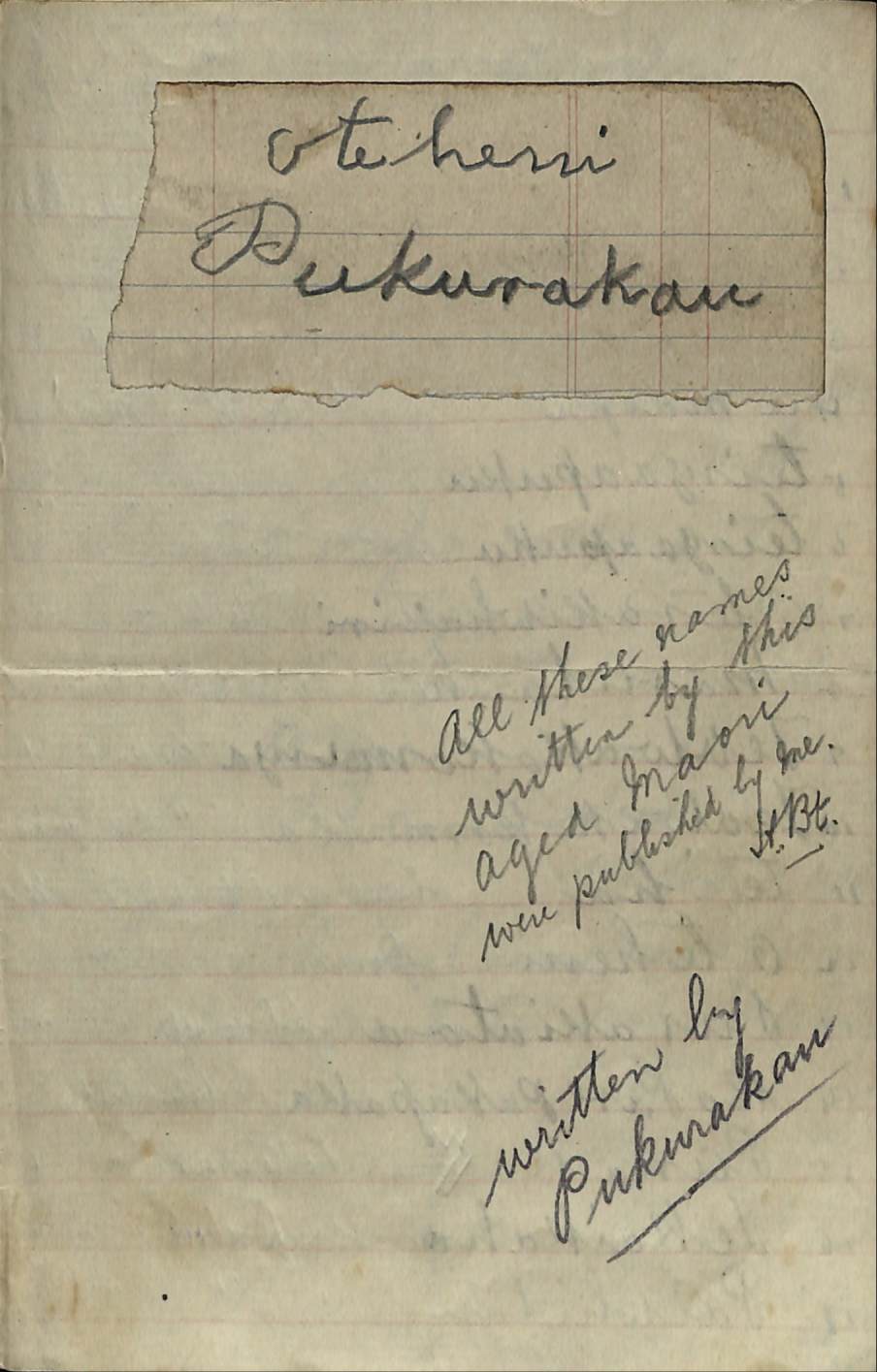
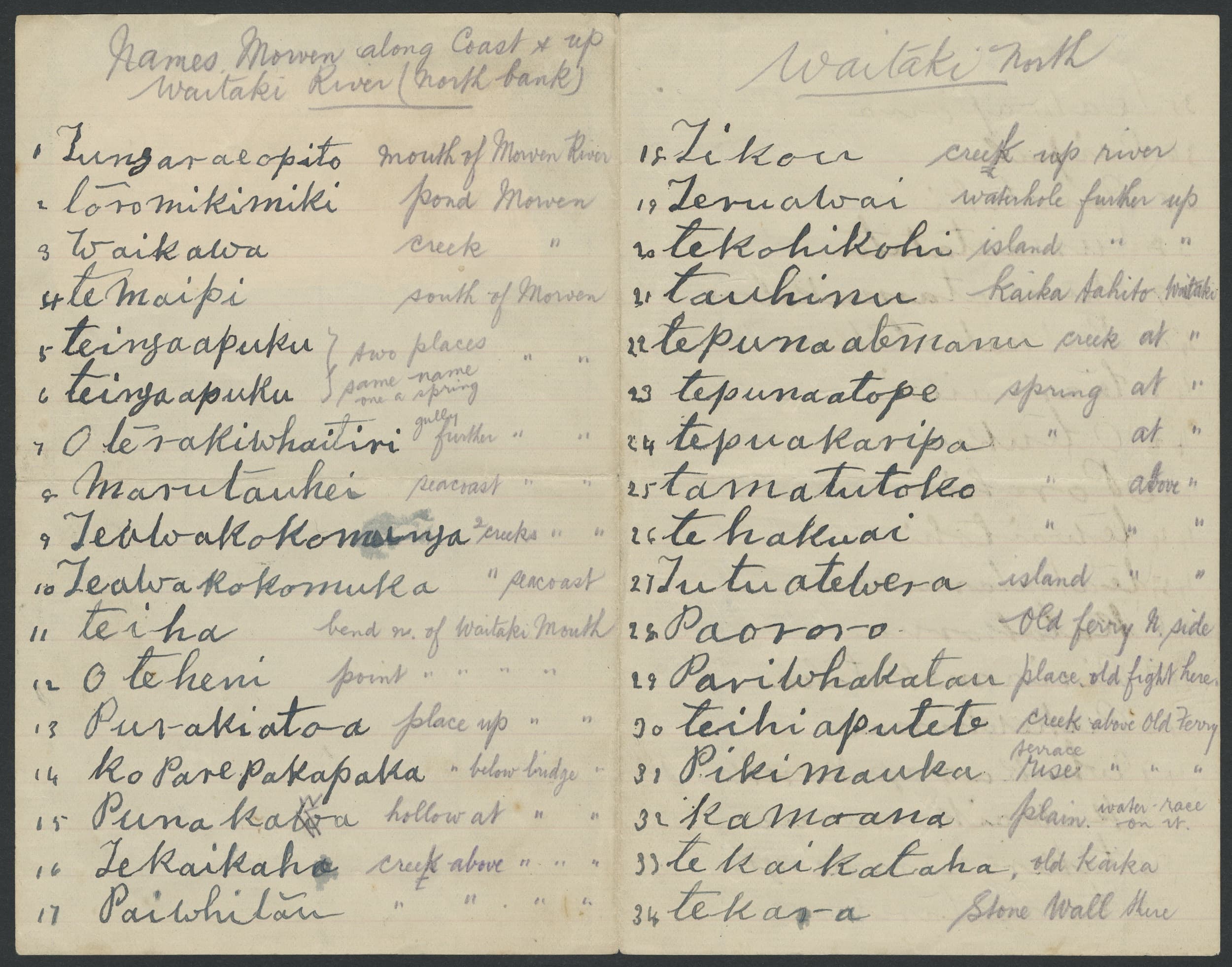
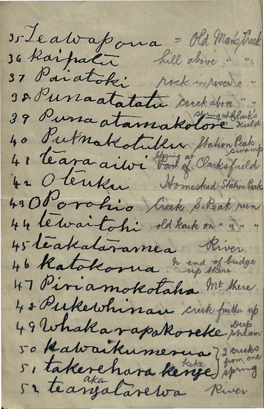
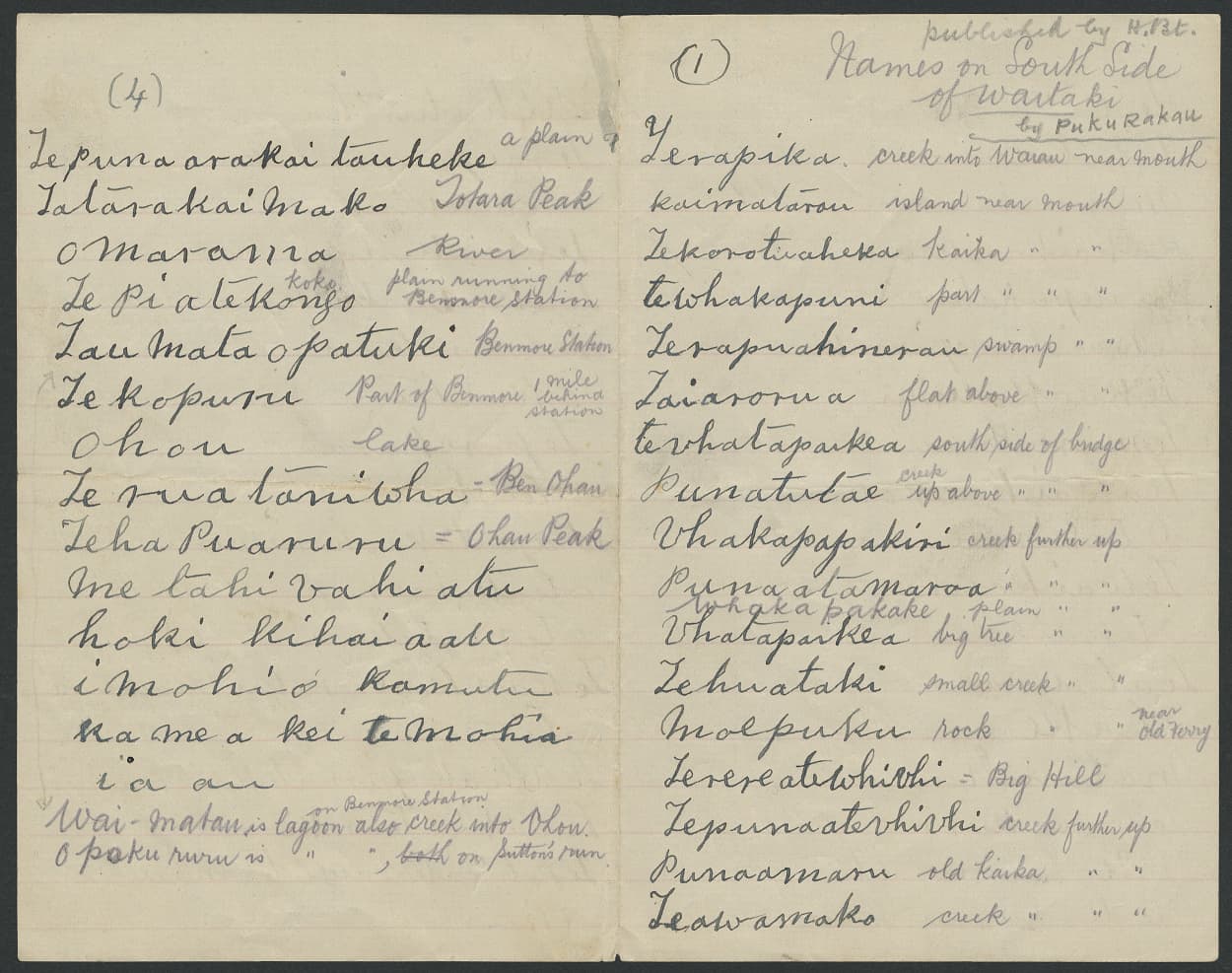
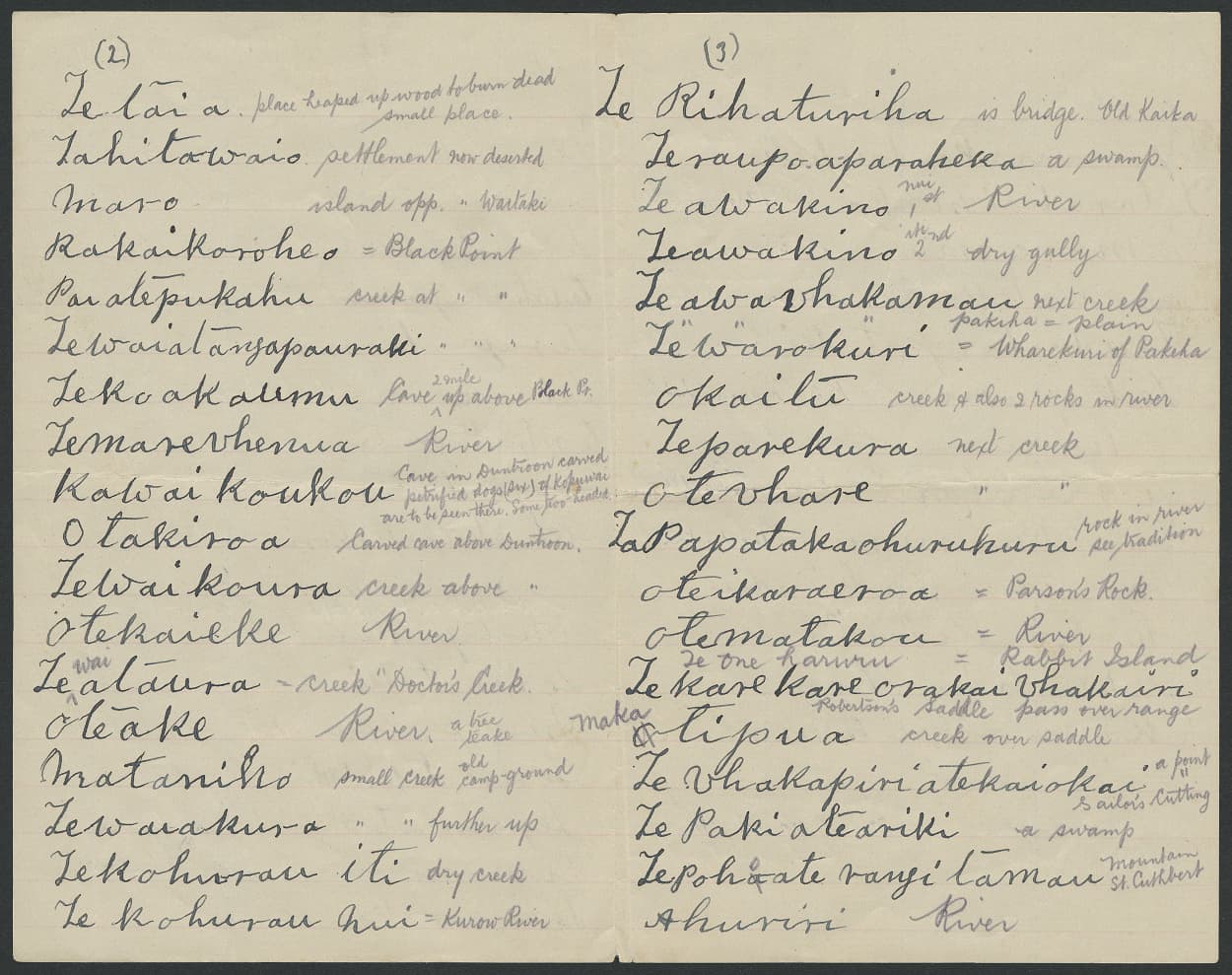
The following day when Beattie was interviewing Taare Te Maiharoa at his hut, Tieke arrived unexpectedly and presented Beattie with two long lists of Māori place names of the Waitaki. Beattie recalled that Tieke ‘went to the trouble of laboriously writing them out and presenting them to a comparative stranger, and without having been approached or solicited in any way’. The two lists were written on ‘sheets of paper covered with his big, childlike handwriting’.
One list outlined the Māori place names situated along the northern bank of the Waitaki, and the second list the place names along the southern bank. These, along with Beattie’s annotations, provide a detailed account of more than one hundred place names of creeks, islands, ponds, gullies, springs and many other landmarks located throughout the Waitaki Valley.
In 1930 Beattie published these place names in the Otago Daily Times as part of his ‘The Southern Maori: Stray Papers’. Some of this material was republished in his books Maori Placenames of Canterbury and Maori Placenames of Otago.
In his later years Tieke lived by himself in his hut at Glenavy, where Beattie continued to visit, repaying Tieke with ‘one or two acts of kindness’ for sharing his knowledge. Described as ‘a silent and reserved man’, Tieke died in February 1925, aged seventy-seven. It is thanks to his knowledge that many of the traditional Māori place names of the Waitaki have been retained, and to his notes that ‘those interested in the preservation of those ancient and correct Maori nomenclature of that region can now trace his footsteps’.

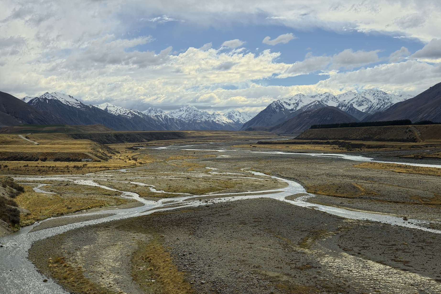
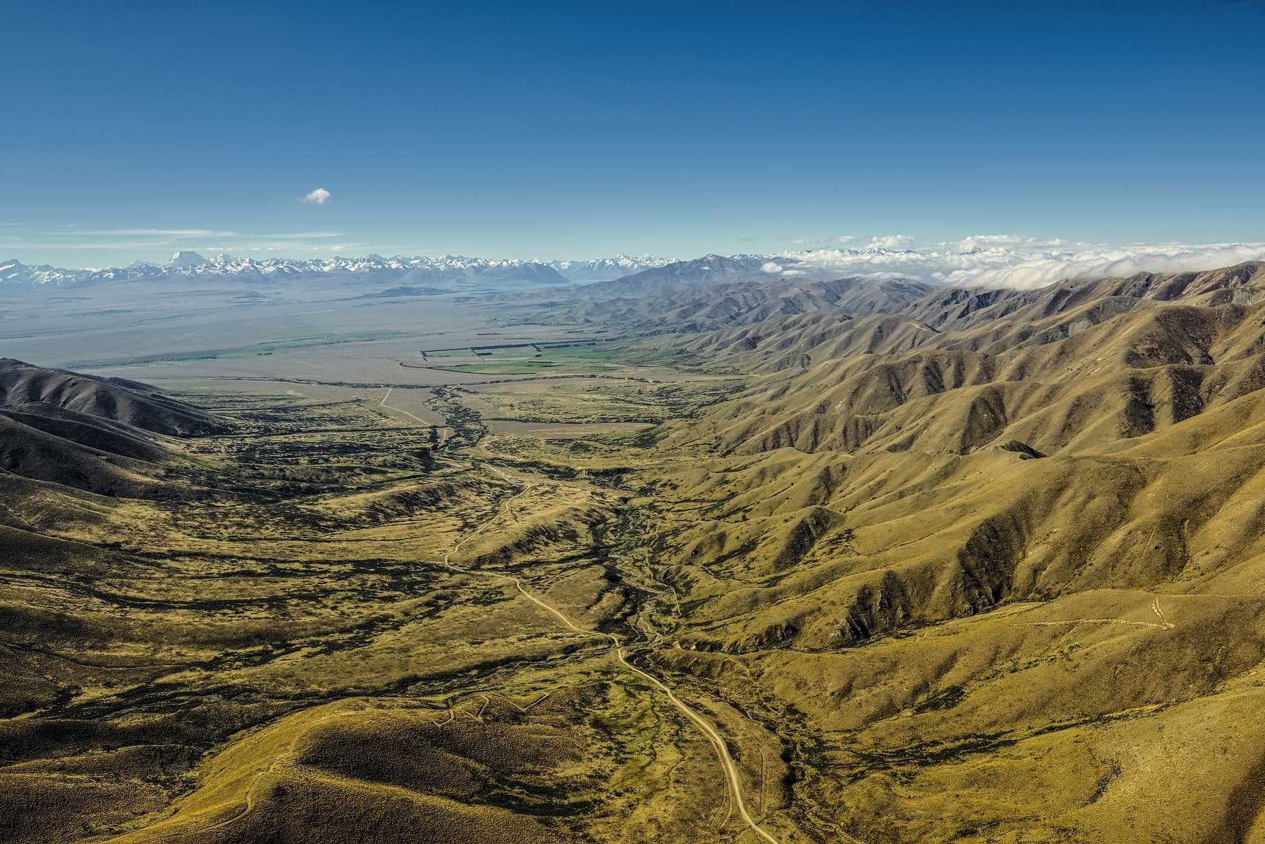
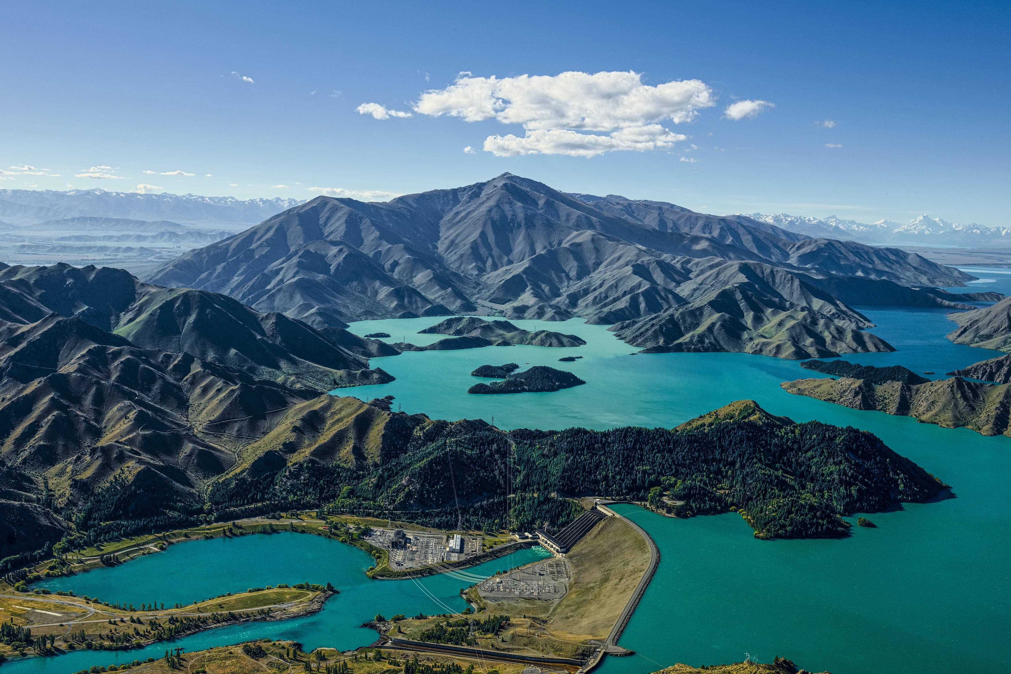
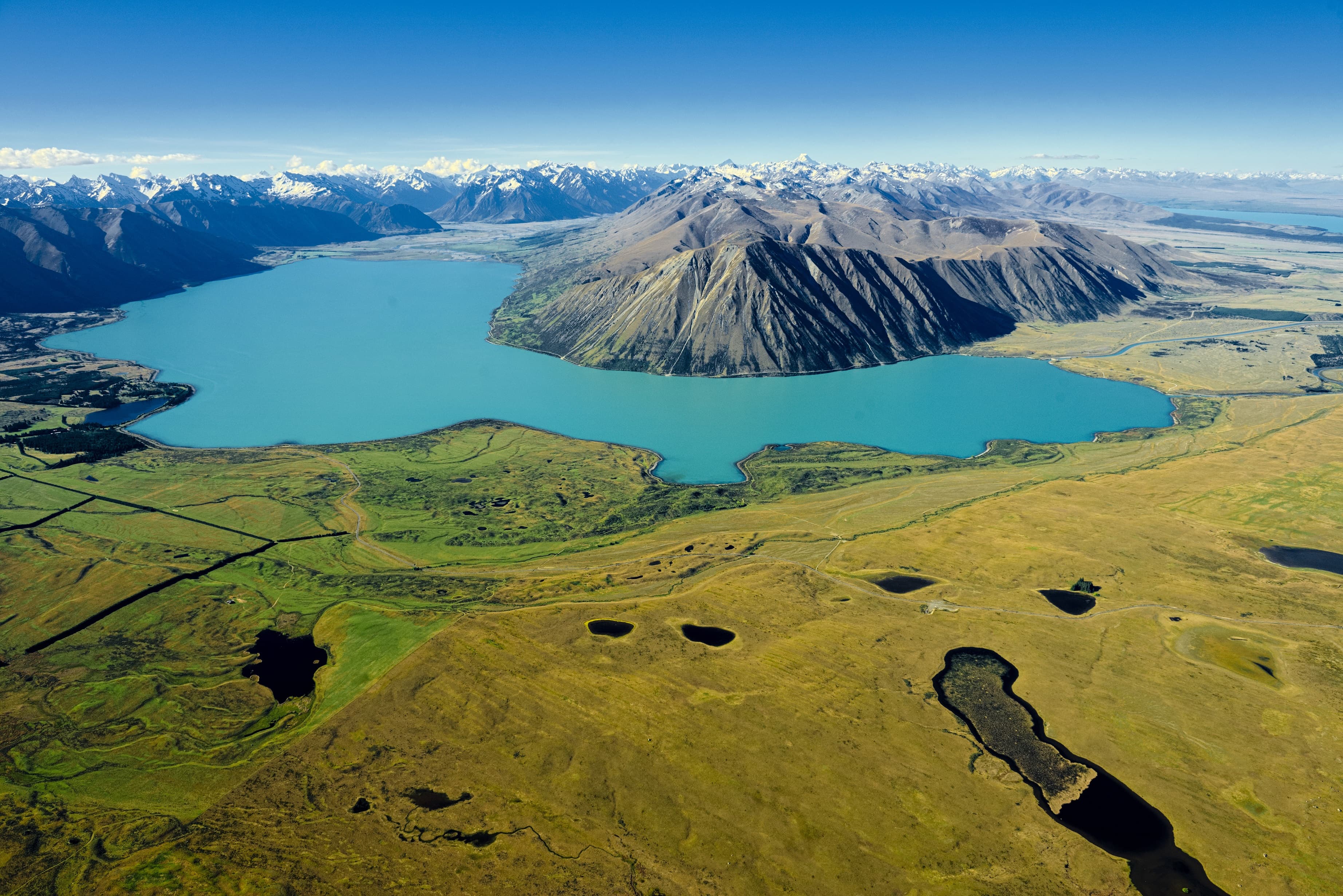
 before reaching the Ahuriri Arm of the man-made Lake Benmore. Prior to the creation of Lake Benmore, the Ahuriri River flowed directly into the Waitaki. In 1877 the visionary religious leader Hipa Te Maiharoa led over 200 people to the Ōmārama settlement on the banks of the Ahuriri River to assert Ngāi Tahu ownership over the interior of Te Waipounamu. During the 1879 Smith-Nairn Royal Commission of Inquiry into the Ngāi Tahu land claims, Ngāi Tahu kaumātua recorded Ahuriri as a kāinga nohoanga (seasonal settlement) and kāinga mahinga kai (food-gathering place) where tuna (eels), pora (‘Māori turnip’), weka, and purau (‘Māori onion’) were gathered.</p>
<p>Te Rūnanga o Ngāi Tahu Collection, Ngāi Tahu Archive, 2014-103</p>")