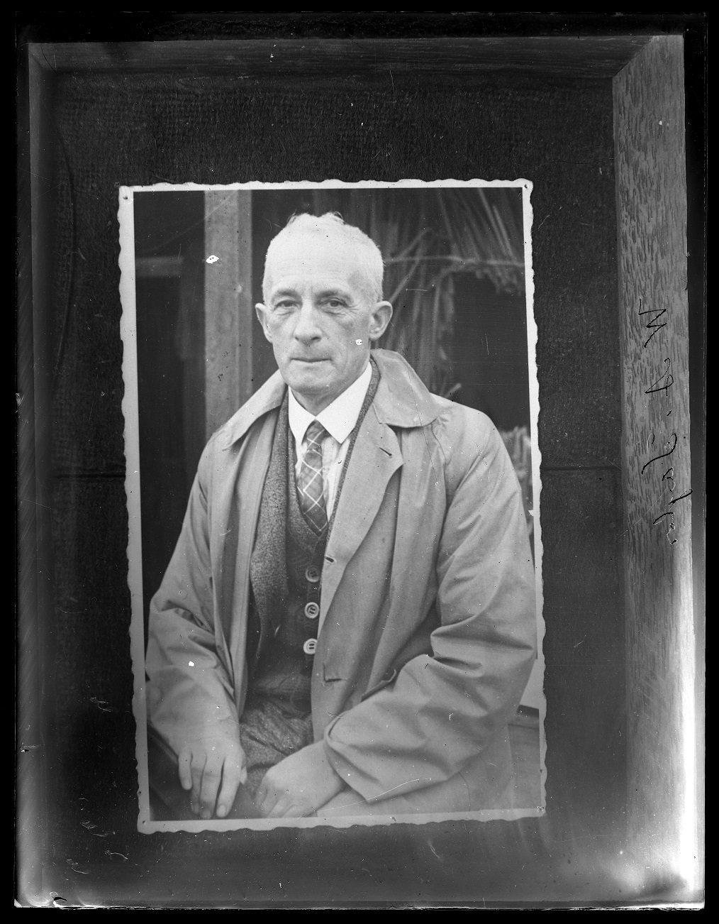
Map maker: William Anderson Taylor
William Anderson Taylor (1882 - 1951) was born in Aberdeen, Scotland in 1882 and emigrated to New Zealand with his parents in 1892. He left school at the age of thirteen to commence a seven-year apprenticeship at the Christchurch Press under the tutelage of his father who was a lithographer and photographer in the newspaper’s illustration department. He subsequently worked as a photographer for several New Zealand newspapers.
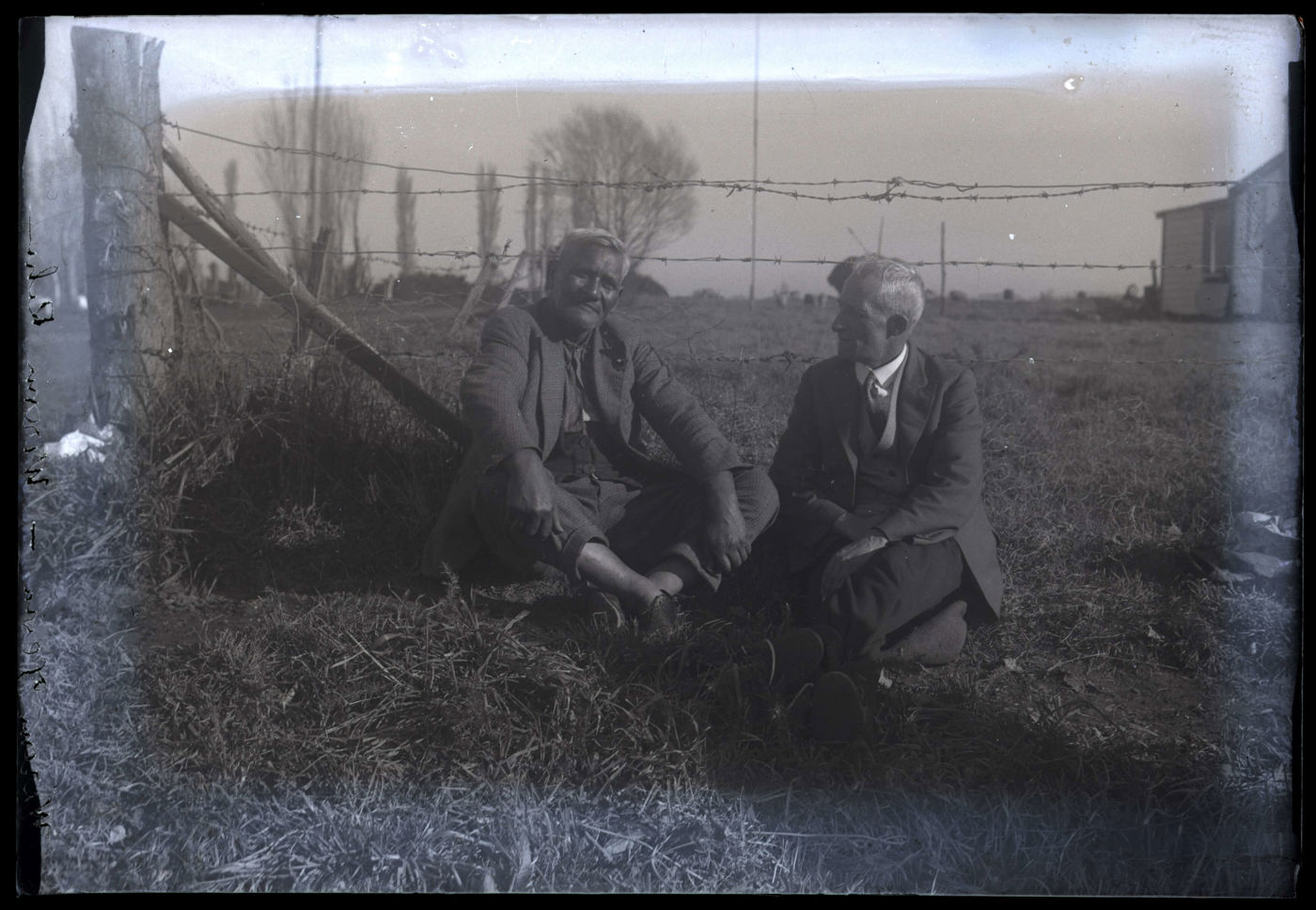
Taylor attributed his life-long interest in Māori history and culture to a chance meeting with a Ngāi Tahu boy his own age, Sam Tini, at the small Ngāi Tahu kāinga of Wairewa (Little River) on Banks Peninsula in 1894. He maintained this friendship for the rest of his life and knew Tini’s grandchildren.
Taylor began compiling ‘Māori history notes’ around 1910 – a practice that led to his eventual compilation of over one hundred notebooks and scrapbooks dedicated to historical subjects. He also took thousands of photographs including many of Ngāi Tahu people and places. He had many Ngāi Tahu friends and acquaintances who knew him as Wiremu Teira.
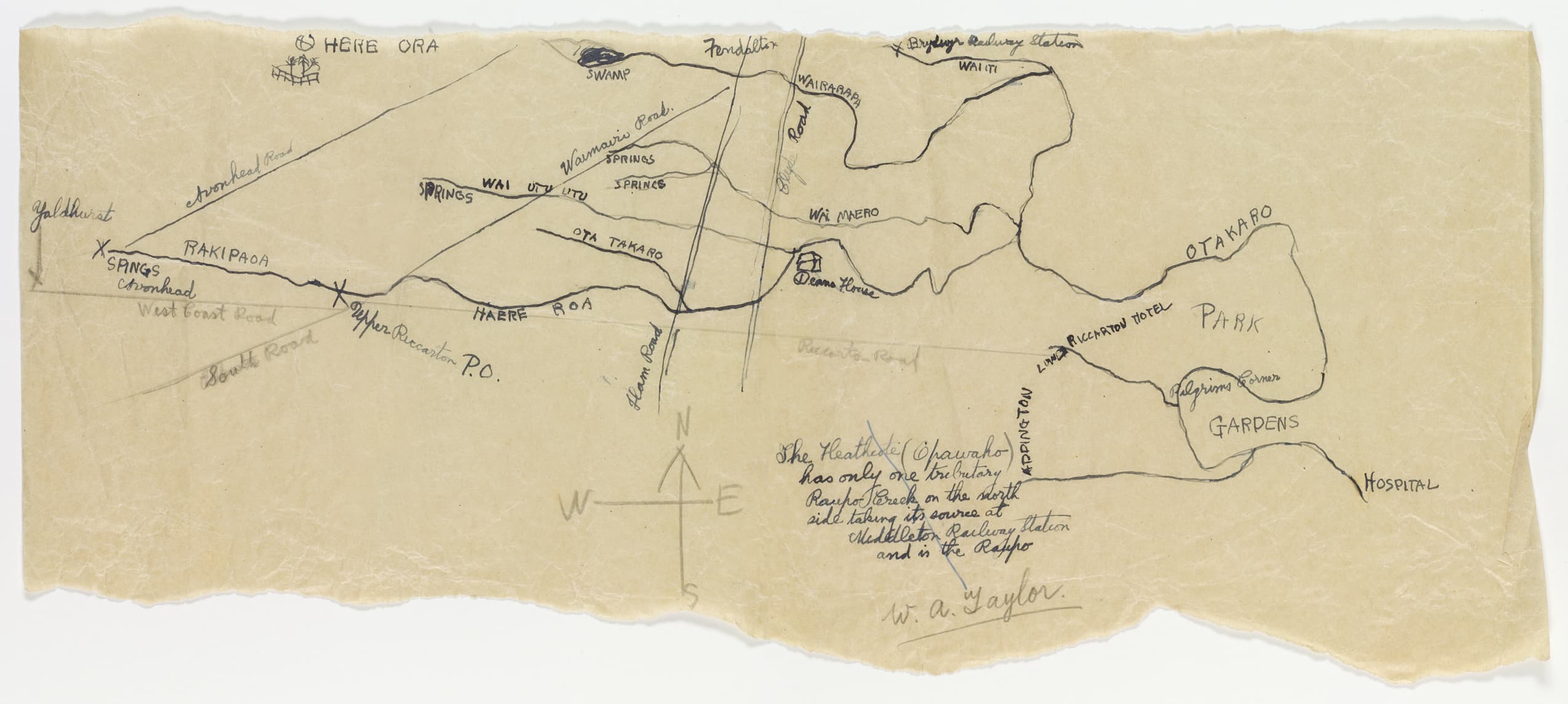
Taylor's sketch plan showing the tributaries of the Ōtākaro to the west of the city is roughly rendered on tracing paper. It was one of two maps he sent to his friend James Herries Beattie as a visual aid to their ongoing conversation about Christchurch waterways.

, āruhe (fernroot), whinau (berry), kanakana (blind eel), pokaka (sp: tree) and korari (stem of flower flax) were gathered there. </span></p>
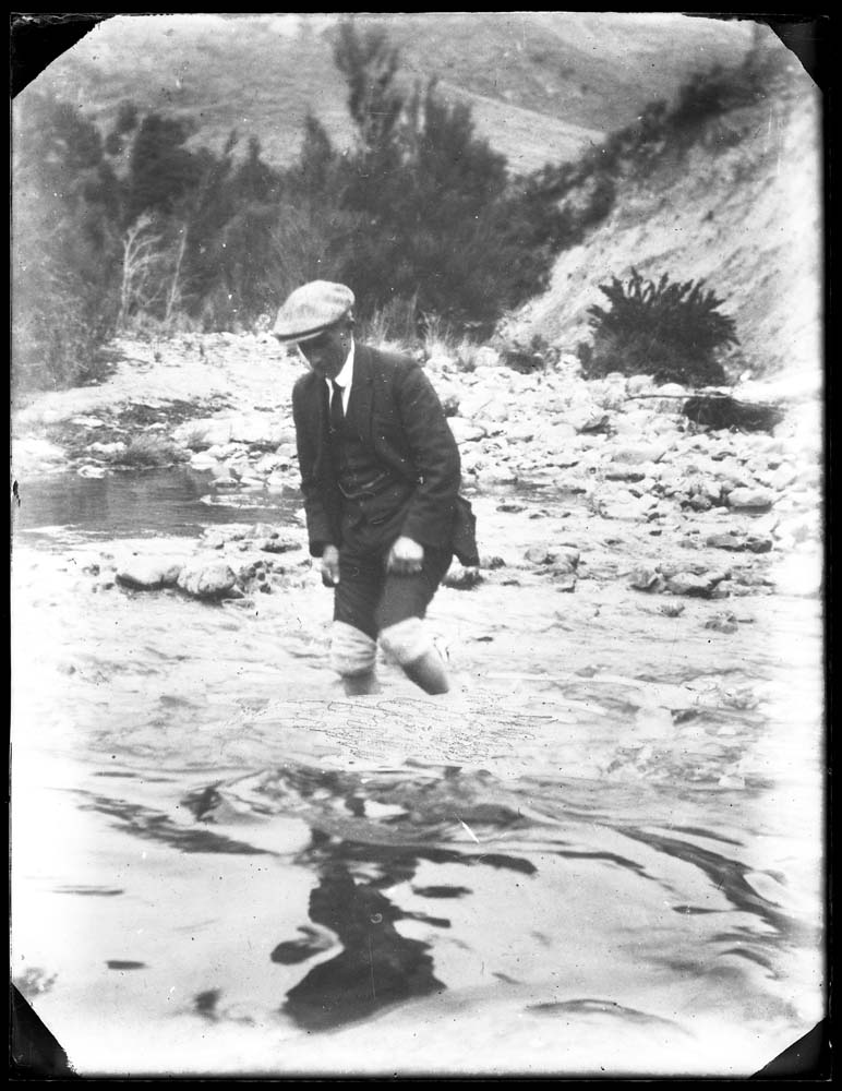
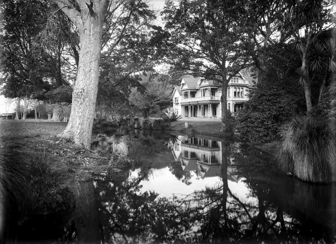
<p>Hereora (also recorded on Taylor's map) was a permanent settlement and food production site located at the headwaters of the Ōtākaro where kāuru (cabbage tree root), āruhe, whitebait, tuna and kiore (rat) were gathered. This photograph of the upper reaches of the Ōtākaro at Avonhead was taken by W.A. Taylor in the 1920s.</p>
<div id=\"main-page\">
<div id=\"jimu-layout-manager\" class=\"PlateauTheme black\">
<div id=\"map\" class=\"map\" data-zoom=\"15\" data-scale=\"18055.954822\" data-loaded=\"\">
<div id=\"map_root\" class=\"esriMapContainer\">
<div class=\"esriPopup esriPopupVisible\">
<div class=\"esriPopupWrapper\">
<div class=\"sizer content\">
<div class=\"contentPane\">
<div id=\"esri_dijit__PopupRenderer_1\" class=\"esriViewPopup\">
<div class=\"mainSection\"><em>W.A. Taylor photograph, Canterbury Museum 1968.214.5451</em></div>
</div>
</div>
</div>
</div>
</div>
</div>
</div>
</div>
</div>")
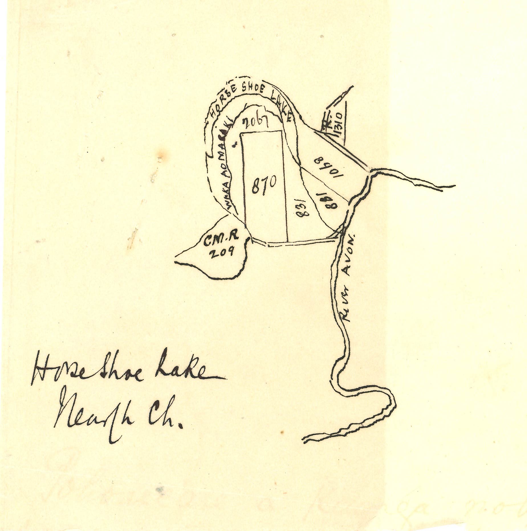
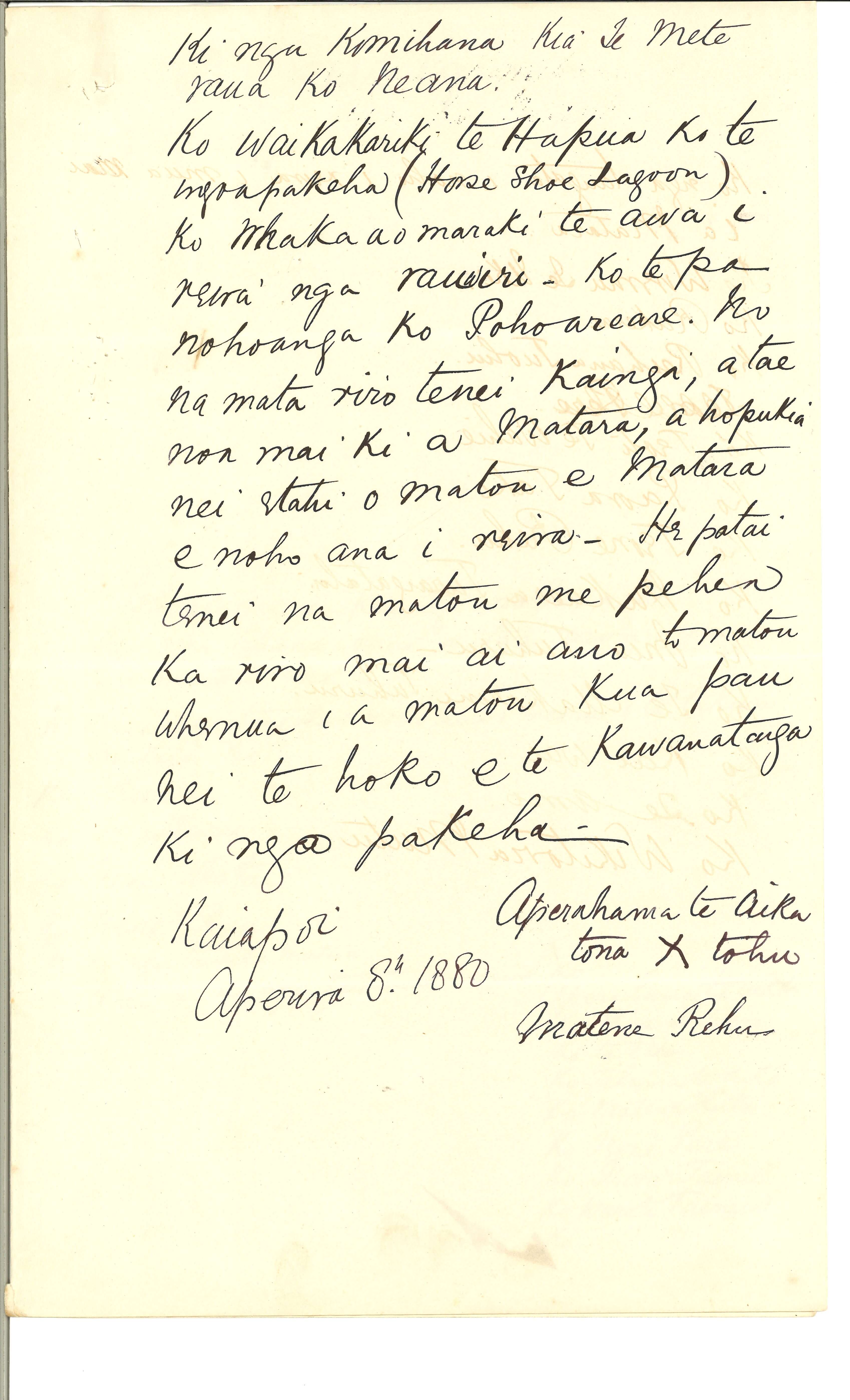
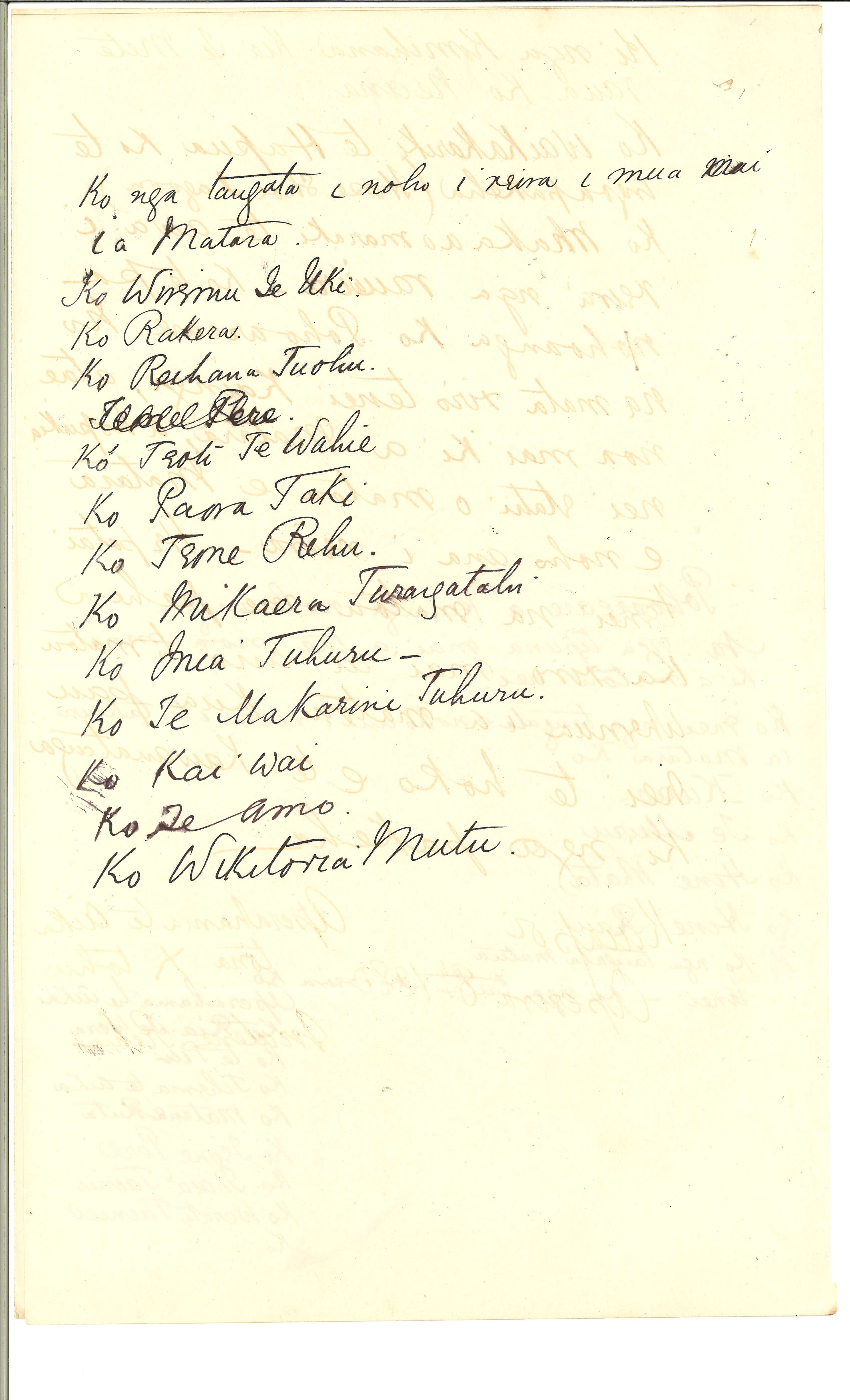
 and associated land parcels. It was part of the evidence presented by Ngāi Tahu to the Middle Island Native Land Claims Commission (Smith Nairn Commission) in 1879 - 80 and was a reassertion of an earlier unsuccessful claim to the area by Teone Pere and Aperahama Te Aika in the Native Land Court in 1868. The 1868 claim had been dismissed by the Court on account of the failure of the claimants to provide a map of the area. </p>
<p>Archives New Zealand, R12726415</p>")